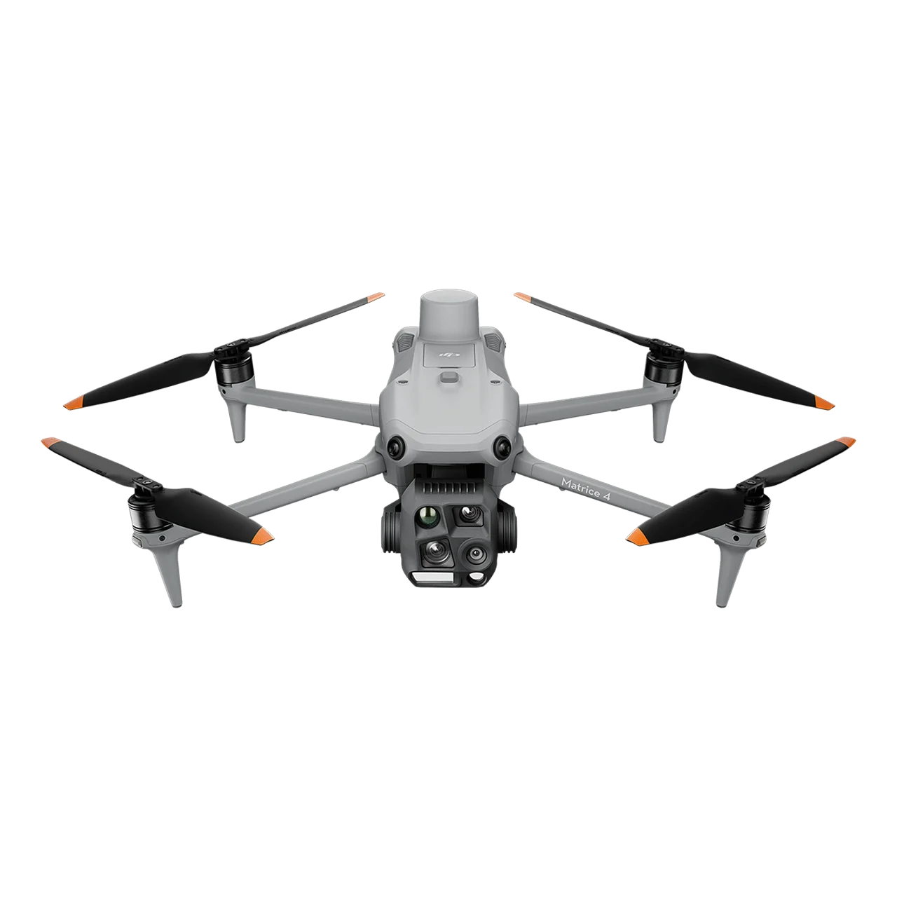
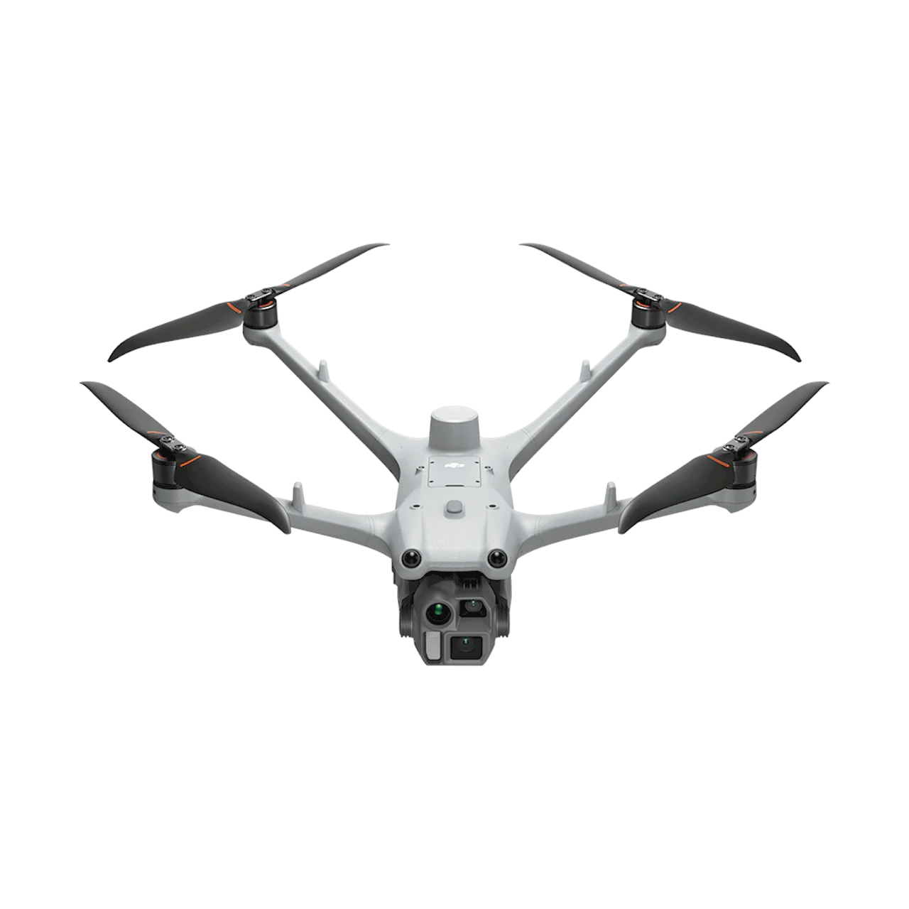
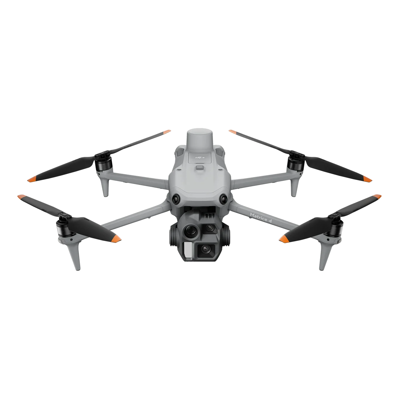
DJI Matrice 4D is a high-performance enterprise drone specifically designed for DJI Dock 3 autonomous operations and professional high-precision mapping applications. Equipped with advanced multi-camera systems including a 4/3 CMOS 20MP wide-angle camera with mechanical shutter, 48MP medium tele camera, 48MP tele camera, and laser range finder, the Matrice 4D excels in detailed surface inspections and surveying tasks. With an impressive 47-minute hovering flight time, IP55 dust and water resistance rating, and compatibility with DJI RC Plus 2 Enterprise for standalone use, this industrial drone delivers unmatched clarity and precision for demanding professional operations in extreme environments. Professional Camera System for High-Precision Mapping Wide-Angle Camera with Mechanical Shutter 4/3 CMOS Sensor – Large sensor for superior image quality 20MP Effective Pixels – High-resolution capture for detailed documentation f/2.8-f/11 Aperture Range – Adjustable aperture for optimal exposure control 24mm Format Equivalent – Wide field of view for comprehensive coverage Mechanical Shutter – Eliminates rolling shutter distortion for high-accuracy photogrammetry 48MP Medium Tele Camera 1/1.3-inch CMOS Sensor – High-quality imaging performance 48MP Effective Pixels – Exceptional detail resolution f/2.8 Aperture – Excellent low-light performance 70mm Format Equivalent – Ideal for medium-range inspections, detecting pins and cracks from 10 meters, and clearly reading instrument data at substations Foreground Stabilization – Upgraded stabilization keeps foreground subjects clear during telephoto shots at 10x zoom or higher 48MP Tele Camera 1/1.5-inch CMOS Sensor – Professional-grade imaging 48MP Effective Pixels – Captures fine details like signs from up to 250m away f/2.8 Aperture – Optimal light gathering capability 168mm Format Equivalent – Long-range inspection capability 80° Upward Gimbal Tilt – Makes bridge underside defects clearly visible when hovering in windless environments Laser Range Finder 1800m Measurement Range – Long-distance precision measurement at 1 Hz 600m Oblique Incidence Range – 1:5 oblique distance capability at 1 Hz 1m Blind Zone – Minimal dead zone for close-range accuracy Range Accuracy – ± (0.2 0.0015 × D) meters for reliable distance measurements Extended Flight Performance and Robust Protection Industry-Leading Flight Time 47 Minutes Hovering Time – When fully charged, delivering 37% increase in operation time 54 Minutes Forward Flying – Extended range capability at 15 m/s speed 18 Minutes Operation at 10 km Radius – Ample working time for remote missions 12 m/s Max Wind Speed Resistance – Stable takeoff, landing, and flight in strong winds up to 32 minutes All-Weather Durability IP55 Protection Rating – Dust and water resistance for harsh environments Low-Noise Anti-Ice Propellers – Maintains stable flight in freezing rain with reduced operational noise Extreme Temperature Operation – Reliable performance in conditions from -30°C to 50°C when deployed with DJI Dock 3 Advanced Obstacle Sensing for Safe Operations Optional Obstacle Sensing Module The Obstacle Sensing Module combines rotating LiDAR and millimeter-wave radar technologies for precise 12mm wire-level obstacle avoidance at speeds up to 15 m/s in complex power line crossings. Enhanced positioning in low-light conditions ensures operational safety in varying environments of power distribution networks and intricate substation layouts. Enhanced Low-Light Capabilities Four High-Resolution Low-Light Fisheye Lenses – Significantly enhanced visual low-light positioning and obstacle sensing Night Scene Mode – Full-color night vision for 24/7 operations IR-Cut Filter Feature – Black-and-white night vision mode for optimal low-light performance High-Precision Surveying and Mapping Excellence Advanced Mapping Capabilities 5-Direction Oblique Photography – Comprehensive 3D modeling from multiple angles 3-Direction Orthophoto Photography – High-accuracy orthomosaic generation Real-Time Terrain Following – Automatic altitude adjustment for consistent ground sampling distance Smart 3D Capture Routes – Intelligent flight path planning for efficient data collection Geometric Routes and Slope Routes – Specialized patterns for diverse terrain mapping DJI FlightHub 2 Integration Enhanced flight route planning options specifically optimized for Matrice 4D operations, including Smart 3D Capture routes, geometric routes, and slope routes, significantly improving efficiency while ensuring detailed modeling for professional surveying applications. Innovative Airborne Relay for Extended Range Seamless Communication in Mountainous Terrains The Matrice 4D features an innovative onboard relay function when paired with DJI RC Plus 2 Enterprise. One drone flies high as a relay while another operates at greater distance. The relay drone automatically faces the operating drone, ensuring smooth video transmission without 4G signal or in obstructed conditions. This capability significantly extends transmission range, making it ideal for SAR tasks and inspections in mountainous areas. Flexible Deployment Options Dual Operation Modes Autonomous Dock Operations – Designed specifically for DJI Dock 3 with automated takeoff, landing, charging, and mission execution Standalone Manual Operations – Pairs with DJI RC Plus 2 Enterprise remote controller for traditional piloted flights Seamless Mode Switching – Switch between autonomous and manual control as operational needs require Open Ecosystem and Developer Support PSDK Payload Integration E-Port and E-Port Lite – Encryption authentication ensures secure payload connections Third-Party Payload Support – Enable additional functionality with certified accessories like parachutes Rear PSDK Port – Additional mounting point for diverse payload configurations Developer Platform Access Mobile SDK 5 – Fully open-source with production code samples of core DJI Pilot 2 modules Cloud API – MQTT-based protocol for direct third-party platform connection DJI Terra API Integration – Automated 2D and 3D reconstruction with customizable photogrammetry workflows Professional Accessories Ecosystem DJI RC Plus 2 Enterprise – High-brightness 7-inch screen remote controller for standalone operations Obstacle Sensing Module – Advanced LiDAR and millimeter-wave radar system DJI 240W Power Adapter – Fast charging for minimal downtime Matrice 4D Series 240W Charging Hub – Multi-battery charging solution DJI Cellular Dongle 2 – Enhanced 4G connectivity for extended range DJI Power 1000 – Portable power station for field operations Application Scenarios Geographic Information and Surveying – High-precision mapping, 3D modeling, and cadastral surveys Powerline Inspection – Detailed transmission line and substation inspections with wire-level obstacle avoidance Roads and Bridges – Infrastructure monitoring, crack detection, and bridge underside inspections Renewable Energy – Wind turbine and solar panel inspections with thermal anomaly detection Oil and Natural Gas – Pipeline corridor monitoring and facility inspections Water Conservancy – Dam inspections, reservoir monitoring, and hydraulic infrastructure surveys Public Safety – Search and rescue operations, disaster assessment, and emergency respons